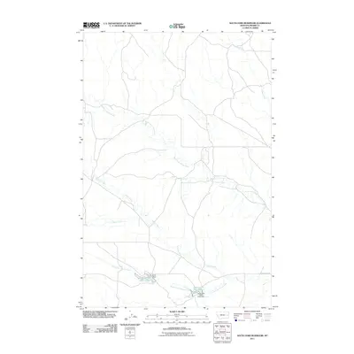
2011 Map of South Fork Reservoir
USGS Topo · Published 2011About this map
Clark Reservoir and South Fork Reservoir anchor this 2011 survey of the Eastern Montana landscape, where the management of water defines the character of the ranching country. The terrain is structured by the dendritic drainage patterns of the North Fork Cherry Creek and the southern Cherry Creek forks, which converge across the quadrangle. Essential infrastructure such as Clark Dam and the South Fork Cherry Creek Dam indicate the regional reliance on these impoundments for local land use. While the area remains largely open rangeland, the presence of Cherry Creek Rd provides a primary corridor through the drainage basins of Morris Creek and Plenty Creek, connecting the scattered water resources that are vital to this part of Prairie County.
Find a feature on this map
10 named features on this map. Tap any name to fly to it.
Don’t see what you’re looking for? This feature index may not catch every label — zoom into the map to look around manually.
Map Details
Editions of this 2011 South Fork Reservoir Map
This is the sole edition of this map. No revisions or reprints were ever made.
Other maps of this area

1953 · Miles City
USGS Topo · 1:250,000

1954 · Glendive
USGS Topo · 1:250,000

1957 · Miles City
USGS Topo · 1:250,000

1957 · Glendive
USGS Topo · 1:250,000

1958 · Miles City
USGS Topo · 1:250,000

1958 · Glendive
USGS Topo · 1:250,000

1965 · Little Sheep Mountain
USGS Topo · 1:24,000

1965 · Watkins SE
USGS Topo · 1:24,000

1965 · Morehouse Creek
USGS Topo · 1:24,000

1972 · Mc Clure Reservoir
USGS Topo · 1:24,000