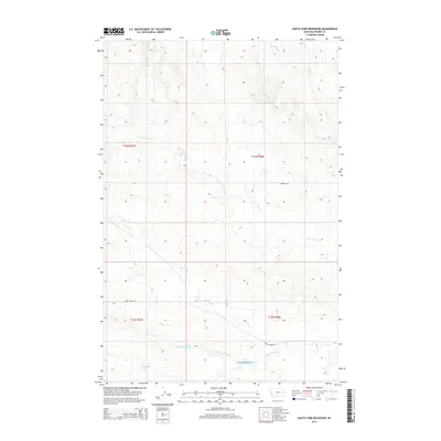
2014 Map of South Fork Reservoir
USGS Topo · Published 2014About this map
The South Fork Reservoir and Clark Reservoir anchor this section of the eastern Montana landscape, reflecting the essential role of water management in Prairie County. The terrain is defined by a dendritic network of drainages, including the N Fork Cherry Cr, S Fork Cherry Cr, and Plenty Cr, which carve through the high plains. Human presence is marked by isolated water sources like Sig Spring and a sparse grid of gravel routes, most notably Cherry Creek Rd and Bowgun Rd. This survey documents a quiet, working landscape where the geography of the creeks dictates the placement of early ranching infrastructure and local transit. The map provides a clear view of the township and range divisions, such as t14n r48e and t13n r47e, which have organized the settlement of this territory since the era of homesteading.
Find a feature on this map
14 named features on this map. Tap any name to fly to it.
Don’t see what you’re looking for? This feature index may not catch every label — zoom into the map to look around manually.
Map Details
Editions of this 2014 South Fork Reservoir Map
This is the sole edition of this map. No revisions or reprints were ever made.
Other maps of this area

1953 · Miles City
USGS Topo · 1:250,000

1954 · Glendive
USGS Topo · 1:250,000

1957 · Miles City
USGS Topo · 1:250,000

1957 · Glendive
USGS Topo · 1:250,000

1958 · Miles City
USGS Topo · 1:250,000

1958 · Glendive
USGS Topo · 1:250,000

1965 · Little Sheep Mountain
USGS Topo · 1:24,000

1965 · Watkins SE
USGS Topo · 1:24,000

1965 · Morehouse Creek
USGS Topo · 1:24,000

1972 · Mc Clure Reservoir
USGS Topo · 1:24,000