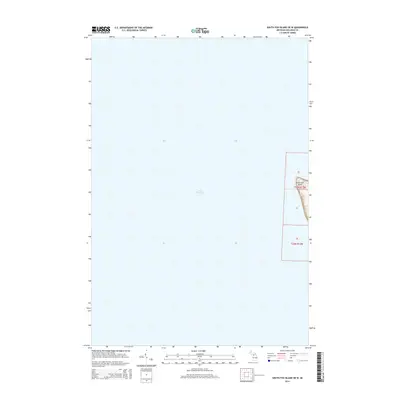
2014 Map of South Fox Island OE W
USGS Topo · Published 2014About this map
South Fox Island is captured in this 2014 topographic study by the U.S. Geological Survey, showing the thin western strip of land where the island meets the expansive waters of Lake Michigan. This specific map represents the westernmost edge of the island's landmass, defined by the Public Land Survey System boundaries of t35n r13w and t34n r13w. The topography reveals the elevated coastal terrain of the island, including sections 30, 31, and 06, which rise from the shoreline. The map focuses on the maritime boundary and the topographical transition from open water to the island's western bluffs, providing a precise record of the shoreline and elevation contours as they existed during the 2012 aerial imagery surveys.
Find a feature on this map
7 named features on this map. Tap any name to fly to it.
Don’t see what you’re looking for? This feature index may not catch every label — zoom into the map to look around manually.
Map Details
Editions of this 2014 South Fox Island OE W Map
This is the sole edition of this map. No revisions or reprints were ever made.
Other maps of this area

1954 · Escanaba
USGS Topo · 1:250,000

1955 · Gull Island
USGS Topo · 1:62,500

1955 · Cheboygan
USGS Topo · 1:250,000

1956 · South Fox Island
USGS Topo · 1:62,500

1957 · Escanaba
USGS Topo · 1:250,000

1958 · Escanaba
USGS Topo · 1:250,000

1958 · Cheboygan
USGS Topo · 1:250,000

1983 · Manistique
USGS Topo · 1:100,000

1984 · Washington Island
USGS Topo · 1:100,000

1984 · Beaver Island
USGS Topo · 1:100,000