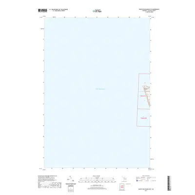
2019 Map of South Fox Island OE W
USGS Topo · Published 2019About this map
South Fox Island sits isolated within the expansive waters of Lake Michigan in this 2019 survey of Leelanau County. The map focuses primarily on the open water of the lake, capturing the western coastal fringe of the island and the surrounding nautical territory. For those studying the geography of the Beaver Island archipelago, this document delineates the specific public land survey boundaries for t35n r13w and t34n r13w. The map provides a precise look at the shoreline topography and the immediate aquatic environment during the late 2010s.
Find a feature on this map
4 named features on this map. Tap any name to fly to it.
Don’t see what you’re looking for? This feature index may not catch every label — zoom into the map to look around manually.
Map Details
Editions of this 2019 South Fox Island OE W Map
This is the sole edition of this map. No revisions or reprints were ever made.
Other maps of this area

1954 · Escanaba
USGS Topo · 1:250,000

1955 · Gull Island
USGS Topo · 1:62,500

1955 · Cheboygan
USGS Topo · 1:250,000

1956 · South Fox Island
USGS Topo · 1:62,500

1957 · Escanaba
USGS Topo · 1:250,000

1958 · Escanaba
USGS Topo · 1:250,000

1958 · Cheboygan
USGS Topo · 1:250,000

1983 · Manistique
USGS Topo · 1:100,000

1984 · Washington Island
USGS Topo · 1:100,000

1984 · Beaver Island
USGS Topo · 1:100,000