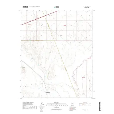
2020 Map of South Garcia
USGS Topo · Published 2020About this map
South Garcia sits at a critical hydrologic and topographic junction in New Mexico, where the Arroyo Garcia meets the broader valley of the Rio San Jose. The landscape is defined by its dramatic mesas, including the prominent Black Mesa and Mesa Redonda, which stand over a network of intermittent watercourses and seasonal springs like Dipping Vat Spring and El Ojo Escondido. This modern survey illustrates the complex intersection of county and tribal boundaries, as Bernalillo, Cibola, and Valencia counties all converge within this quadrant. Transportation in this arid region is anchored by the corridor of Interstate 40 in the north and a series of dedicated access routes such as Canoncito School Rd and Indian Svc Rte 548, providing vital connections through the desert terrain toward the Rio Puerco drainage system.
Find a feature on this map
20 named features on this map. Tap any name to fly to it.
Don’t see what you’re looking for? This feature index may not catch every label — zoom into the map to look around manually.
Map Details
Editions of this 2020 South Garcia Map
This is the sole edition of this map. No revisions or reprints were ever made.
Other maps of this area

1883 · Mt. Taylor
USGS Topo · 1:250,000

1886 · Mt. Taylor
USGS Topo · 1:250,000

1888 · Bernalillo
USGS Topo · 1:125,000

1889 · Albuquerque
USGS Topo · 1:125,000

1892 · Mt. Taylor
USGS Topo · 1:250,000

1893 · Albuquerque
USGS Topo · 1:125,000

1899 · Mt. Taylor
USGS Topo · 1:250,000

1917 · Cerro Verde
USGS Topo · 1:125,000

1952 · Rio Puerco
USGS Topo · 1:24,000

1952 · Dalies NW
USGS Topo · 1:24,000