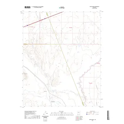
2023 Map of South Garcia
USGS Topo · Published 2023About this map
The high desert landscape of central New Mexico is defined here by the confluence of major seasonal drainages and striking geological formations. The Rio San Jose winds through the southwestern section, joining the Rio Puerco as it flows south through Bernalillo and Valencia counties. This territory is marked by prominent landforms such as Black Mesa and Mesa Redonda, which overlook the surrounding arroyos. Historical water sources like Dipping Vat Spring and El Ojo Escondido suggest the importance of local hydrology in this arid region.
Find a feature on this map
19 named features on this map. Tap any name to fly to it.
Don’t see what you’re looking for? This feature index may not catch every label — zoom into the map to look around manually.
Map Details
Editions of this 2023 South Garcia Map
This is the sole edition of this map. No revisions or reprints were ever made.
Other maps of this area

1883 · Mt. Taylor
USGS Topo · 1:250,000

1886 · Mt. Taylor
USGS Topo · 1:250,000

1888 · Bernalillo
USGS Topo · 1:125,000

1889 · Albuquerque
USGS Topo · 1:125,000

1892 · Mt. Taylor
USGS Topo · 1:250,000

1893 · Albuquerque
USGS Topo · 1:125,000

1899 · Mt. Taylor
USGS Topo · 1:250,000

1917 · Cerro Verde
USGS Topo · 1:125,000

1952 · Rio Puerco
USGS Topo · 1:24,000

1952 · Dalies NW
USGS Topo · 1:24,000