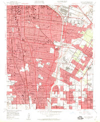
1949 Map of South Gate
USGS Topo · Published 1960About this map
Industrial expansion and residential development define the corridor between South Gate and Compton in the late 1940s. The landscape is a dense network of rail and road, where the Pacific Electric and Southern Pacific lines serve growing neighborhoods like Lynwood and Cudahy. A unique mix of institutional and cultural landmarks is visible, from the historic Lugo Adobe and the sprawl of Rancho Los Amigos (Hondo PO) to the Angeles Abbey Mausoleum.
Find a feature on this map
137 named features on this map. Tap any name to fly to it.
Don’t see what you’re looking for? This feature index may not catch every label — zoom into the map to look around manually.
Map Details
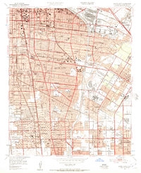
Editions of this 1949 South Gate Map
2 editions found
Other maps of this area

1894 · Los Angeles
USGS Topo · 1:62,500

1896 · Pasadena
USGS Topo · 1:62,500

1896 · Redondo
USGS Topo · 1:62,500

1896 · Santa Monica
USGS Topo · 1:62,500

1896 · Downey
USGS Topo · 1:62,500

1898 · Santa Monica
USGS Topo · 1:62,500

1899 · Downey
USGS Topo · 1:62,500

1900 · Pasadena
USGS Topo · 1:62,500

1900 · Los Angeles
USGS Topo · 1:62,500

1901 · Southern California Sheet No. 1
USGS Topo · 1:250,000