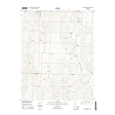
2015 Map of South Greenfield
USGS Topo · Published 2015About this map
Turnback Creek and its many tributaries carve a network of bluffs and hollows across this Missouri landscape. The area is defined by its small, scattered agricultural settlements including South Greenfield, Pennsboro, and Pilgrim. This 2015 survey reveals a terrain rich with family history, marked by numerous small burial grounds such as Friend Cemetery, Merrick Cemetery, and Bishop Cemetery. The presence of Dilday Mill and Snadon Ford suggests the historical importance of the local waterways for early industry and transport. From the Daughtrey Bluff overlooks to the lowlands of Stillhouse Hollow, the map documents a region where local names are deeply tied to the physical geography. The boundary between Dade and Lawrence counties crosses the southern portion, near the settlement of Olinger, illustrating the persistent administrative and social divisions of the rural Ozark plateau.
Find a feature on this map
89 named features on this map. Tap any name to fly to it.
Don’t see what you’re looking for? This feature index may not catch every label — zoom into the map to look around manually.
Map Details
Editions of this 2015 South Greenfield Map
This is the sole edition of this map. No revisions or reprints were ever made.
Other maps of this area

1886 · Greenfield
USGS Topo · 1:125,000

1888 · Greenfield
USGS Topo · 1:125,000

1919 · Halltown
USGS Topo · 1:62,500

1921 · Stotts City
USGS Topo · 1:62,500

1954 · Springfield
USGS Topo · 1:250,000

1955 · Dadeville
USGS Topo · 1:24,000
1956 · Kings Point
USGS Topo · 1:24,000

1956 · Greenfield
USGS Topo · 1:24,000
1956 · Lockwood
USGS Topo · 1:24,000
1956 · South Greenfield
USGS Topo · 1:24,000