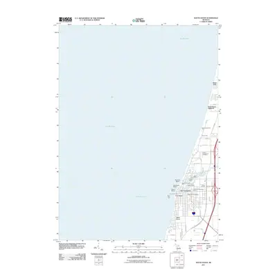
2011 Map of South Haven
USGS Topo · Published 2011About this map
Lake Michigan dominates the western half of this coastal survey, where the Black River carves a deep inlet into the shoreline at South Haven. This maritime geography defines the local economy and layout, evidenced by the concentration of harbor infrastructure such as the South Haven Municipal Marina, Pothole Marina, and the dual beacons of the North Pier Light and South Pier Light. The residential and recreational patterns follow the coast, stretching from the northern enclave of Miami Park down to Indian Grove. Genealogical and local history interest is anchored by the presence of Lake View Cemetery and the Hebrew Cemetery on the eastern edge of the settlement. The map also traces the transition of former infrastructure into modern use, notably the Van Buren Trl, while showing established local institutions like the South Haven Post Office.
Find a feature on this map
40 named features on this map. Tap any name to fly to it.
Don’t see what you’re looking for? This feature index may not catch every label — zoom into the map to look around manually.
Map Details
Editions of this 2011 South Haven Map
This is the sole edition of this map. No revisions or reprints were ever made.
Other maps of this area

1927 · Bangor
USGS Topo · 1:62,500

1927 · South Haven
USGS Topo · 1:62,500

1928 · Fennville
USGS Topo · 1:62,500

1930 · South Haven
USGS Topo · 1:62,500

1931 · Fennville
USGS Topo · 1:62,500

1931 · Bangor
USGS Topo · 1:62,500

1943 · South Haven
USGS Topo · 1:62,500

1943 · Bangor
USGS Topo · 1:62,500

1958 · Racine
USGS Topo · 1:250,000

1962 · Racine
USGS Topo · 1:250,000
Featured Places
- South Haven, MI
- Indian Grove, South Haven
- South Haven Highlands, MI
- South Haven Charter Township, MI
- Casco Township, MI