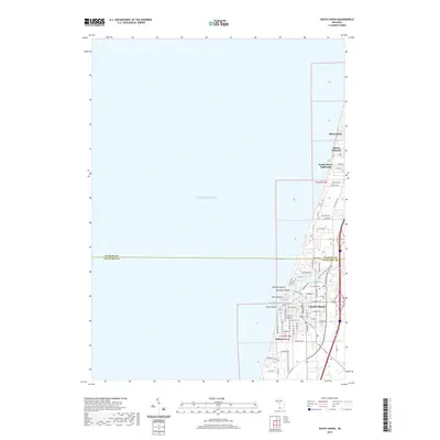
2019 Map of South Haven
USGS Topo · Published 2019About this map
Lake Michigan dominates the western half of this coastal survey, where the Black River flows through the South Haven Harbor into the open water. The city of South Haven serves as the central hub, situated where the river meet the lake. The coastline is defined by a string of lakeside neighborhoods and beaches stretching north, including Miami Park, Mount Pleasant, and Dyckman Beach. This map documents the intersection of modern recreational infrastructure and local heritage, tracing the paths of the Van Buren Trail State Park and Kal-Haven Trail State Park as they converge near the town center.
Find a feature on this map
49 named features on this map. Tap any name to fly to it.
Don’t see what you’re looking for? This feature index may not catch every label — zoom into the map to look around manually.
Map Details
Editions of this 2019 South Haven Map
This is the sole edition of this map. No revisions or reprints were ever made.
Other maps of this area

1927 · Bangor
USGS Topo · 1:62,500

1927 · South Haven
USGS Topo · 1:62,500

1928 · Fennville
USGS Topo · 1:62,500

1930 · South Haven
USGS Topo · 1:62,500

1931 · Fennville
USGS Topo · 1:62,500

1931 · Bangor
USGS Topo · 1:62,500

1943 · South Haven
USGS Topo · 1:62,500

1943 · Bangor
USGS Topo · 1:62,500

1958 · Racine
USGS Topo · 1:250,000

1962 · Racine
USGS Topo · 1:250,000
Featured Places
- South Haven, MI
- Indian Grove, South Haven
- South Haven Highlands, MI
- South Haven Charter Township, MI
- Casco Township, MI