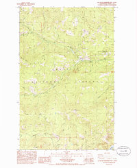
1985 Map of South Huckleberry Mtn.
USGS Topo · Published 1985About this map
Colville National Forest dominates this mid-1980s terrain in Ferry County, where the landscape is defined by the high elevations of South Huckleberry Mtn and the long, sloping contours of Scalawag Ridge. The area serves as a significant drainage basin for several streams, most notably Sherman Creek, which is fed by numerous tributaries including Milk Creek and Hart Creek. The presence of the Sherman Creek State Wildlife Rec Area indicates a focus on conservation and managed wilderness during this period.
Find a feature on this map
23 named features on this map. Tap any name to fly to it.
Don’t see what you’re looking for? This feature index may not catch every label — zoom into the map to look around manually.
Map Details
Editions of this 1985 South Huckleberry Mtn. Map
This is the sole edition of this map. No revisions or reprints were ever made.
Other maps of this area

1936 · Marcus
USGS Topo · 1:96,000

1942 · Marcus
USGS Topo · 1:125,000

1948 · Sherman Peak
USGS Topo · 1:62,500

1948 · Kettle Falls
USGS Topo · 1:62,500

1950 · Inchelium
USGS Topo · 1:62,500

1951 · Sherman Peak
USGS Topo · 1:62,500

1951 · Kettle Falls
USGS Topo · 1:62,500

1952 · Twin Lakes
USGS Topo · 1:62,500

1954 · Okanogan
USGS Topo · 1:250,000

1958 · Okanogan
USGS Topo · 1:250,000