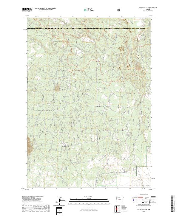
2023 Map of South Ice Cave
USGS Topo · Published 2023About this map
Newberry Volcano dominates the northern reaches of this high-altitude landscape where Lake and Deschutes counties meet. The terrain is defined by volcanic features, including the high-relief Lava Pass and the drainage patterns of Issa Draw. Human activity here centers on timber management and recreation within the Deschutes National Forest, evidenced by a dense network of specialized pathways like Ohv #49 Trl and Ohv #30 Trl.
Find a feature on this map
24 named features on this map. Tap any name to fly to it.
Don’t see what you’re looking for? This feature index may not catch every label — zoom into the map to look around manually.
Map Details
Editions of this 2023 South Ice Cave Map
This is the sole edition of this map. No revisions or reprints were ever made.
Other maps of this area

1931 · Newberry Crater
USGS Topo · 1:125,000

1935 · Newberry Crater
USGS Topo · 1:125,000

1955 · Crescent
USGS Topo · 1:250,000

1957 · Crescent
USGS Topo · 1:250,000

1958 · Crescent
USGS Topo · 1:250,000

1970 · Crescent
USGS Topo · 1:250,000
1974 · Newberry Crater 4 NW
USGS Topo · 1:24,000

1979 · Crescent
USGS Topo · 1:100,000

1981 · Cougar Mtn
USGS Topo · 1:24,000
1981 · Cabin Lake
USGS Topo · 1:24,000