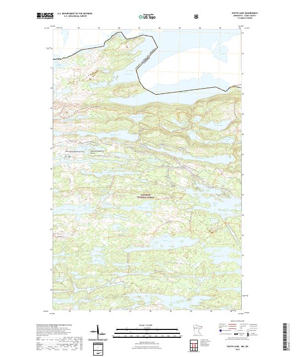
2022 Map of South Lake
USGS Topo · Published 2022About this map
Superior National Forest encompasses this wilderness boundary region, where the international border between the United States and Canada bisects a chain of deep glacial waters including South Lake, North Lake, and Gunflint Lake. The landscape is defined by an intricate network of portages and footpaths that trace the historic travel corridors of the Boundary Waters. The Gunflint Trail serves as the primary modern artery, paralleled by remnants of the older transportation network such as Iron Lake Road (Old Gunflint). Traditional Ojibwe place names are preserved on the map with Moozoogitagaaning Island and Moozoogitagaanesing Island in West Pope Lake. This recent survey details the modern recreational infrastructure within the forest, from the Banadad Trl to the Poplar Lake Boat Access P L, while documenting the unchanged natural topography of the Pine River and Frances Bay.
Find a feature on this map
72 named features on this map. Tap any name to fly to it.
Don’t see what you’re looking for? This feature index may not catch every label — zoom into the map to look around manually.
Map Details
Editions of this 2022 South Lake Map
This is the sole edition of this map. No revisions or reprints were ever made.
Other maps of this area

1919 · Brule Lake
USGS Topo · 1:62,500

1954 · Two Harbors
USGS Topo · 1:250,000

1957 · Two Harbors
USGS Topo · 1:250,000

1957 · Quetico
USGS Topo · 1:250,000

1958 · Two Harbors
USGS Topo · 1:250,000

1959 · Lima Mountain
USGS Topo · 1:24,000

1959 · Hungry Jack Lake
USGS Topo · 1:24,000
1960 · South Lake
USGS Topo · 1:24,000
1960 · Eagle Mountain
USGS Topo · 1:24,000

1960 · Brule Lake
USGS Topo · 1:24,000