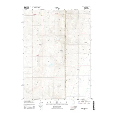
2014 Map of South Lake
USGS Topo · Published 2014About this map
South Lake and N Lake sit at the heart of this high-altitude landscape along the border of Utah and Wyoming. The terrain is defined by a series of north-south running ridges and canyons, most notably Lake Ridge and the Boundary Hills. Water sources are critical in this environment, evidenced by named features like Mud Spring, Stirrup Spring, and Big Bend Spring. To the southeast, the Bear River flows near the junction of several townships, while the drainage of Rabbit Cr and Christy Cr cuts through the upland plateaus. The placement of CR 207 provides a primary corridor through South Lake Canyon, connecting these remote basins. This area reflects a classic intermountain western topography where natural springs and seasonal creeks dictate the geography of the high country.
Find a feature on this map
28 named features on this map. Tap any name to fly to it.
Don’t see what you’re looking for? This feature index may not catch every label — zoom into the map to look around manually.
Map Details
Editions of this 2014 South Lake Map
This is the sole edition of this map. No revisions or reprints were ever made.
Other maps of this area

1909 · Montpelier
USGS Topo · 1:125,000

1911 · Montpelier
USGS Topo · 1:125,000

1912 · Randolph
USGS Topo · 1:125,000

1936 · Cokeville
USGS Topo · 1:96,000

1942 · Cokeville
USGS Topo · 1:125,000

1954 · Sage
USGS Topo · 1:62,500

1954 · Ogden
USGS Topo · 1:250,000

1955 · Preston
USGS Topo · 1:250,000

1958 · Ogden
USGS Topo · 1:250,000

1958 · Preston
USGS Topo · 1:250,000