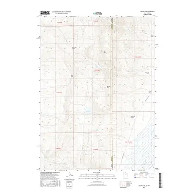
2017 Map of South Lake
USGS Topo · Published 2017About this map
South Lake and North Lake occupy a high-elevation plateau along the border of Rich County, Utah, and Lincoln County, Wyoming. This interior drainage basin is characterized by numerous seasonal springs and watercourses, including Mud Spring, Stirrup Spring, and Big Bend Spring. The landscape transitions from prominent topographic features like Red Knoll and Lake Ridge in the west to the deep incisions of South Lake Canyon and North Lake Canyon in the east. In the lower southeastern corner, the Bear River enters the frame, accompanied by the McFarland Ditch, marking a shift toward the irrigated agricultural and riverine economy of the valley floor. The map documents a sparsely settled region defined by its water management and the rugged boundary line between the two states.
Find a feature on this map
30 named features on this map. Tap any name to fly to it.
Don’t see what you’re looking for? This feature index may not catch every label — zoom into the map to look around manually.
Map Details
Editions of this 2017 South Lake Map
This is the sole edition of this map. No revisions or reprints were ever made.
Other maps of this area

1909 · Montpelier
USGS Topo · 1:125,000

1911 · Montpelier
USGS Topo · 1:125,000

1912 · Randolph
USGS Topo · 1:125,000

1936 · Cokeville
USGS Topo · 1:96,000

1942 · Cokeville
USGS Topo · 1:125,000

1954 · Sage
USGS Topo · 1:62,500

1954 · Ogden
USGS Topo · 1:250,000

1955 · Preston
USGS Topo · 1:250,000

1958 · Ogden
USGS Topo · 1:250,000

1958 · Preston
USGS Topo · 1:250,000