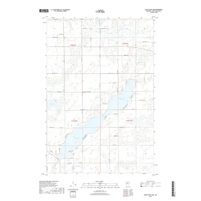
2019 Map of South Long Lake
USGS Topo · Published 2019About this map
Upper South Long Lake and Lower Long Lake dominate this central Minnesota landscape, connected by a narrow channel and surrounded by a dense network of residential and rural roads. The area shows significant shoreline development, particularly along Paradise Shores Rd and the southwestern banks of Lower Long Lake. To the north, the Nokasippi River and Sand Cr meander through wetland-heavy terrain before joining the larger lake system. Two established burial sites, Bethel Cem near Thompson Rd and Hillside Cem further south, provide important reference points for local genealogists. The road network, including Co Rd 144 and Co Rd 23 SE, suggests a transition from dense lakeside settlement to more open timbered tracts and marshes near Mud Lake and the smaller Russell Lake.
Find a feature on this map
58 named features on this map. Tap any name to fly to it.
Don’t see what you’re looking for? This feature index may not catch every label — zoom into the map to look around manually.
Map Details
Editions of this 2019 South Long Lake Map
This is the sole edition of this map. No revisions or reprints were ever made.
Other maps of this area

1912 · Deerwood
USGS Topo · 1:62,500

1914 · Deerwood
USGS Topo · 1:62,500

1915 · Brainerd
USGS Topo · 1:62,500

1918 · Brainerd
USGS Topo · 1:62,500

1948 · Lastrup
USGS Topo · 1:62,500

1950 · Lastrup
USGS Topo · 1:62,500

1953 · Duluth
USGS Topo · 1:250,000

1953 · Brainerd
USGS Topo · 1:250,000

1957 · Brainerd
USGS Topo · 1:250,000

1958 · Brainerd
USGS Topo · 1:250,000