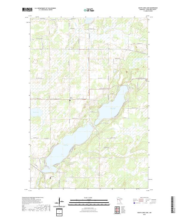
2022 Map of South Long Lake
USGS Topo · Published 2022About this map
Upper South Long Lake and Lower Long Lake dominate this landscape southeast of Brainerd, where the Nokasippi River and Sand Cr define the hydrologic character of the region. The map captures a transition between residential development and the natural wetlands characteristic of this part of Minnesota. Local genealogy interests are well-served by the inclusion of several burial grounds, including Maple Grove Cem, Bethel Lutheran Cem, and Hillside Cem, which are scattered among the township sections. Recreational infrastructure is prominent via the Crow Wing Southern Loop Trl, which winds through the central and eastern portions of the map. The road network, featuring names like Town Line Rd and Five Mile Rd, reflects the rigid section-line surveying of the Public Land Survey System while navigating around natural obstacles like Russell Lake and Mud Lake.
Find a feature on this map
60 named features on this map. Tap any name to fly to it.
Don’t see what you’re looking for? This feature index may not catch every label — zoom into the map to look around manually.
Map Details
Editions of this 2022 South Long Lake Map
This is the sole edition of this map. No revisions or reprints were ever made.
Other maps of this area

1912 · Deerwood
USGS Topo · 1:62,500

1914 · Deerwood
USGS Topo · 1:62,500

1915 · Brainerd
USGS Topo · 1:62,500

1918 · Brainerd
USGS Topo · 1:62,500

1948 · Lastrup
USGS Topo · 1:62,500

1950 · Lastrup
USGS Topo · 1:62,500

1953 · Duluth
USGS Topo · 1:250,000

1953 · Brainerd
USGS Topo · 1:250,000

1957 · Brainerd
USGS Topo · 1:250,000

1958 · Brainerd
USGS Topo · 1:250,000