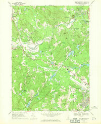
1968 Map of South Merrimack
USGS Topo · Published 1971About this map
The Souhegan River carves a winding path through the heart of southern New Hampshire, defining the rural and industrial landscape of the late 1960s. This survey captures a mix of small village centers like Cricket Corner and Ponemah alongside growing municipal infrastructure near Nashua. The influence of the Boston and Maine Railroad is prominent, running alongside the river and passing landmarks such as the Amherst Country Club and the aviation activity at Boire Field.
Find a feature on this map
92 named features on this map. Tap any name to fly to it.
Don’t see what you’re looking for? This feature index may not catch every label — zoom into the map to look around manually.
Map Details
Editions of this 1968 South Merrimack Map
4 editions found
Other maps of this area

1886 · Lowell
USGS Topo · 1:62,500

1893 · Lowell
USGS Topo · 1:62,500

1893 · Groton
USGS Topo · 1:62,500

1905 · Manchester
USGS Topo · 1:62,500

1906 · Milford
USGS Topo · 1:62,500

1918 · Lowell
USGS Topo · 1:62,500

1921 · Lowell
USGS Topo · 1:62,500

1931 · Lowell
USGS Topo · 1:48,000

1931 · Groton
USGS Topo · 1:48,000

1935 · Groton
USGS Topo · 1:62,500