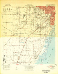
1950 Map of South Miami
USGS Topo · Published 1950About this map
Coral Gables and the developing suburbs of southern Miami-Dade County appear here in the post-war era, showing a landscape defined by large institutional campuses and residential expansion. The University of Miami occupies a significant tract just north of the Coral Gables Canal, while recreational and research spaces like Matheson Hammock Park and the Fairchild Tropical Garden line the shores of Biscayne Bay. The transition from urban grids to open agricultural and transition land is evident as one moves inland toward Kendall and Rockdale.
Find a feature on this map
45 named features on this map. Tap any name to fly to it.
Don’t see what you’re looking for? This feature index may not catch every label — zoom into the map to look around manually.
Map Details
Editions of this 1950 South Miami Map
2 editions found
Other maps of this area

1947 · Key Biscayne
USGS Topo · 1:24,000

1948 · Soldier Key
USGS Topo · 1:24,000

1949 · South Miami NW
USGS Topo · 1:24,000

1949 · Key Biscayne
USGS Topo · 1:24,000

1949 · Goulds
USGS Topo · 1:24,000

1949 · Perrine
USGS Topo · 1:24,000

1950 · Hialeah
USGS Topo · 1:24,000

1950 · Miami
USGS Topo · 1:24,000

1950 · South Miami
USGS Topo · 1:24,000

1955 · South Miami NW
USGS Topo · 1:24,000