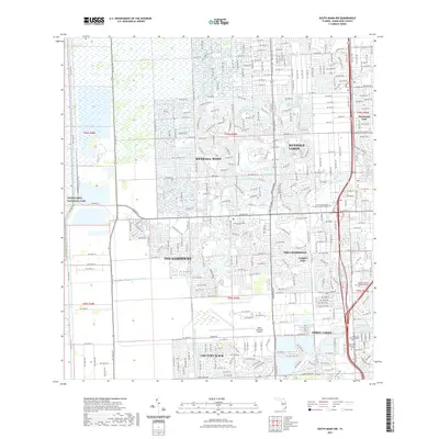
2021 Map of South Miami NW
USGS Topo · Published 2021About this map
Kendall West and Kendale Lakes define the master-planned suburban landscape of southwestern Miami-Dade County, characterized by an intricate network of artificial waterways and residential enclaves. This modern survey reflects a region transformed by extensive water management, where the Snapper Creek Canal and Black Creek Canal regulate the flow through dense neighborhoods like The Hammocks and Country Walk. The eastern edge of the Everglades National Park meets the suburban sprawl along the western boundary, providing a sharp contrast between the preserved wetlands and the highly engineered environment of The Crossings. Significant infrastructure supports the growing population, including the Miami Executive Airport and the Nova Southeastern University Miami Campus. For genealogists, the map identifies several large interment sites such as Caballero Rivero Woodlawn South Cem and Pine Lawn Memorial Cem, which serve the surrounding communities of Three Lakes and Westwood Lake.
Find a feature on this map
38 named features on this map. Tap any name to fly to it.
Don’t see what you’re looking for? This feature index may not catch every label — zoom into the map to look around manually.
Map Details
Editions of this 2021 South Miami NW Map
This is the sole edition of this map. No revisions or reprints were ever made.
Other maps of this area

1949 · South Miami NW
USGS Topo · 1:24,000

1949 · Goulds
USGS Topo · 1:24,000

1949 · Perrine
USGS Topo · 1:24,000

1950 · Hialeah
USGS Topo · 1:24,000

1950 · South Miami
USGS Topo · 1:24,000

1955 · South Miami NW
USGS Topo · 1:24,000

1956 · Goulds
USGS Topo · 1:24,000

1956 · Perrine
USGS Topo · 1:24,000

1956 · South Miami
USGS Topo · 1:24,000

1956 · Grossman Hammock
USGS Topo · 1:24,000