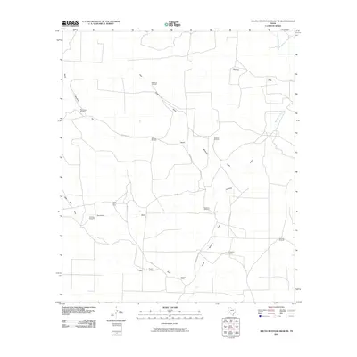
2010 Map of South Mustang Draw NE
USGS Topo · Published 2010About this map
The Middle Concho River cuts through the northeast corner of this arid West Texas landscape, an area characterized by its extensive network of seasonal watercourses and critical water-pumping infrastructure. The map reveals a ranching economy reliant on scattered landmarks like the East Snow Windmill, Rainbow Windmill, and Dogtown Windmill to sustain life across the expansive draws. Small ranch outposts and settlements such as Chandler, Elbow Line Camp, and Vat Line Camp provide the only residential footprints in a territory otherwise dominated by topographical features like North Mustang Draw and Centralia Draw. The presence of these named camps and numerous windmills suggests a persistent pastoral land use where water sources define the geography and movement. Surveyed in 2010, the sheet documents the sparse but functional human presence required to manage large-scale Texas ranchlands.
Find a feature on this map
23 named features on this map. Tap any name to fly to it.
Don’t see what you’re looking for? This feature index may not catch every label — zoom into the map to look around manually.
Map Details
Editions of this 2010 South Mustang Draw NE Map
This is the sole edition of this map. No revisions or reprints were ever made.
Other maps of this area

1921 · Ketchum Mountain
USGS Topo · 1:62,500

1923 · Ketchum Mountain
USGS Topo · 1:62,500

1954 · San Angelo
USGS Topo · 1:250,000

1958 · San Angelo
USGS Topo · 1:250,000

1965 · San Angelo
USGS Topo · 1:250,000

1970 · South Mustang Draw SE
USGS Topo · 1:24,000

1970 · South Mustang Draw NE
USGS Topo · 1:24,000

1970 · Moore Hill
USGS Topo · 1:24,000
1970 · Divide Draw
USGS Topo · 1:24,000

1973 · Hay Hollow
USGS Topo · 1:24,000