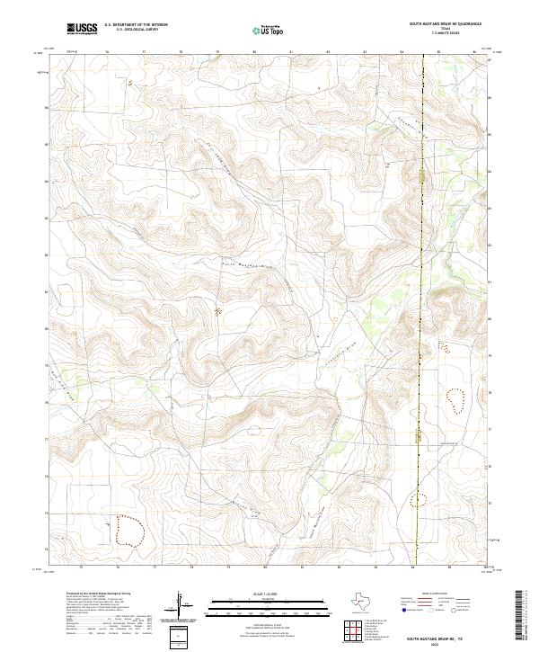
2022 Map of South Mustang Draw NE
USGS Topo · Published 2022About this map
Middle Concho River defines the eastern edge of this arid West Texas landscape, where the high plains are deeply dissected by a network of drainage features. The terrain is characterized by a series of significant draws that channel seasonal runoff toward the river basin, including the sprawling North Mustang Draw and the adjacent Centralia Draw. This 2022 survey captures the modern road network supporting the region's ranching operations, with Vat Rd and Highland Pens Rd cutting across the upland plateaus. The map also delineates the jurisdictional boundary between Reagan and Irion counties, providing a clear view of how political lines intersect with the natural topography of East Snow Draw and Brushy Draw.
Find a feature on this map
13 named features on this map. Tap any name to fly to it.
Don’t see what you’re looking for? This feature index may not catch every label — zoom into the map to look around manually.
Map Details
Editions of this 2022 South Mustang Draw NE Map
This is the sole edition of this map. No revisions or reprints were ever made.
Other maps of this area

1921 · Ketchum Mountain
USGS Topo · 1:62,500

1923 · Ketchum Mountain
USGS Topo · 1:62,500

1954 · San Angelo
USGS Topo · 1:250,000

1958 · San Angelo
USGS Topo · 1:250,000

1965 · San Angelo
USGS Topo · 1:250,000

1970 · South Mustang Draw SE
USGS Topo · 1:24,000

1970 · South Mustang Draw NE
USGS Topo · 1:24,000

1970 · Moore Hill
USGS Topo · 1:24,000
1970 · Divide Draw
USGS Topo · 1:24,000

1973 · Hay Hollow
USGS Topo · 1:24,000