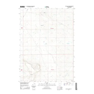
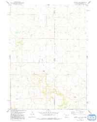
2015 Map of South Oat Creek
USGS Topo · Published 2015About this map
Seaman Hills dominate the southwestern reaches of this Niobrara County landscape, where the high plains of eastern Wyoming meet a complex system of drainages and seasonal water storage. The area is defined by its ranching infrastructure, most notably the Wallace Number 2 Reservoir and Pfister Number 2 Reservoir, which anchor the central and eastern sections of the quadrangle. A network of rural routes including Boner Rd and Cummings Rd provides access through varied terrain, from the depths of Walker Canyon to the northern Clay Canyon. The drainage patterns here are intricate, with several forks of Brush Cr and N Oat Cr carving through the dry earth toward the southern Eagle Draw. This map reveals how water management and topography have dictated the footprint of human movement and land use in this sparsely populated region.
Find a feature on this map
22 named features on this map. Tap any name to fly to it.
Don’t see what you’re looking for? This feature index may not catch every label — zoom into the map to look around manually.
Map Details
Editions of this 2015 South Oat Creek Map
This is the sole edition of this map. No revisions or reprints were ever made.
Other maps of this area

1954 · Torrington
USGS Topo · 1:250,000

1955 · Newcastle
USGS Topo · 1:250,000

1958 · Torrington
USGS Topo · 1:250,000

1958 · Newcastle
USGS Topo · 1:250,000

1978 · Shepherds Point
USGS Topo · 1:24,000

1978 · Coffee Flats
USGS Topo · 1:24,000
1978 · Oat Creek NW
USGS Topo · 1:24,000
1978 · South Oat Creek
USGS Topo · 1:24,000
1978 · Oat Creek
USGS Topo · 1:24,000
1978 · Sherrill Hills
USGS Topo · 1:24,000