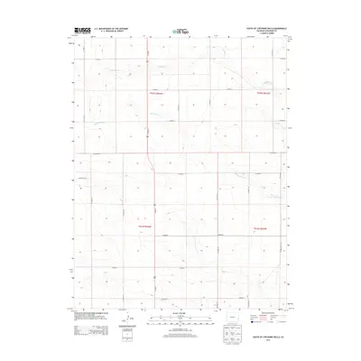
2013 Map of South of Cheyenne Wells
USGS Topo · Published 2013About this map
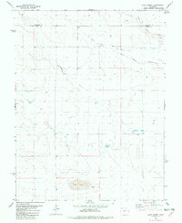
The high plains of eastern Colorado stretch across this 2013 landscape, dominated by a vast grid of section lines and gravel paths south of the High Plains town of Cheyenne Wells. The hydrology of this arid region is defined by ephemeral drainages such as White Woman Cr and S Ladder Cr, which carve subtle depressions through the prairie. Modern transport is anchored by Us-385 N, a primary north-south artery that bisects the map, crossing east-west routes like CO Highway G. This survey documents a land organized by the Public Land Survey System, featuring township boundaries for t015s r044w and t016s r043w. The map reveals the meticulous rural infrastructure of the region, where named county roads like CO Road K and CO Road F serve as the lifeblood for dispersed agricultural holdings.
Find a feature on this map
24 named features on this map. Tap any name to fly to it.
Don’t see what you’re looking for? This feature index may not catch every label — zoom into the map to look around manually.
Map Details
Editions of this 2013 South of Cheyenne Wells Map
This is the sole edition of this map. No revisions or reprints were ever made.
Other maps of this area

1892 · Cheyenne Wells
USGS Topo · 1:125,000

1894 · Cheyenne Wells
USGS Topo · 1:125,000

1954 · Lamar
USGS Topo · 1:250,000

1958 · Lamar
USGS Topo · 1:250,000

1981 · Cheyenne Wells
USGS Topo · 1:100,000

1982 · Cheyenne Wells SW
USGS Topo · 1:24,000
1982 · Cheyenne Wells
USGS Topo · 1:24,000
1982 · Cheyenne Wells 3 SW
USGS Topo · 1:24,000
1982 · Cheyenne Wells 3 NW
USGS Topo · 1:24,000
1982 · Lake Albert
USGS Topo · 1:24,000