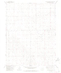
1982 Map of Cheyenne Wells 3 NW
USGS Topo · Published 1982About this map
Golden Spike Oil Field characterizes the industrial activity on this Colorado landscape during the early 1980s. The terrain is marked by a network of energy infrastructure, including several Oil Wells and a prominent Tank. The drainage of South Ladder Creek meanders across the northern sections, cutting through the high plains topography.
Find a feature on this map
7 named features on this map. Tap any name to fly to it.
Don’t see what you’re looking for? This feature index may not catch every label — zoom into the map to look around manually.
Map Details
Editions of this 1982 Cheyenne Wells 3 NW Map
2 editions found
Other maps of this area

1891 · Kit Carson
USGS Topo · 1:125,000

1892 · Cheyenne Wells
USGS Topo · 1:125,000

1893 · Kit Carson
USGS Topo · 1:125,000

1894 · Cheyenne Wells
USGS Topo · 1:125,000

1954 · Lamar
USGS Topo · 1:250,000

1958 · Lamar
USGS Topo · 1:250,000

1981 · Cheyenne Wells
USGS Topo · 1:100,000
1982 · Kit Carson 4 SE
USGS Topo · 1:24,000

1982 · Cheyenne Wells SW
USGS Topo · 1:24,000

1982 · Kit Carson 4 NE
USGS Topo · 1:24,000