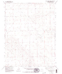
1982 Map of South Ladder Creek
USGS Topo · Published 1995About this map
The Golden Spike Oil Field dominates the landscape of eastern Colorado in this early 1980s survey, illustrating the industrial footprint of energy extraction in Cheyenne County. While the terrain is defined by the winding course of South Ladder Creek, the human influence is marked by scattered infrastructure typical of the High Plains. Sparse but significant markers of utility and agricultural storage appear across the sections, including several sites labeled Oil Well, a Tank, and a solitary Well. Near the northeastern corner, Storage Bins stand along the sections, providing a glimpse into the grain and resource management essential to this rural ranching and drilling district during the late twentieth century.
Find a feature on this map
8 named features on this map. Tap any name to fly to it.
Don’t see what you’re looking for? This feature index may not catch every label — zoom into the map to look around manually.
Map Details
Editions of this 1982 South Ladder Creek Map
2 editions found
Other maps of this area

1891 · Kit Carson
USGS Topo · 1:125,000

1892 · Cheyenne Wells
USGS Topo · 1:125,000

1893 · Kit Carson
USGS Topo · 1:125,000

1894 · Cheyenne Wells
USGS Topo · 1:125,000

1954 · Lamar
USGS Topo · 1:250,000

1958 · Lamar
USGS Topo · 1:250,000

1981 · Cheyenne Wells
USGS Topo · 1:100,000
1982 · Kit Carson 4 SE
USGS Topo · 1:24,000

1982 · Cheyenne Wells SW
USGS Topo · 1:24,000

1982 · Kit Carson 4 NE
USGS Topo · 1:24,000