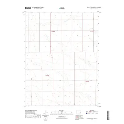
2019 Map of South of Cheyenne Wells
USGS Topo · Published 2019About this map
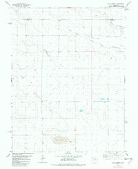
S Ladder Cr and White Woman Cr define the high plains drainage of this Cheyenne County landscape as it appeared in the late 2010s. This agricultural and ranching territory is organized by a precise grid of county roads, including Co RD 44 and Co RD 49, which delineate the expansive township and range sections. The primary north-south artery, Highway 385, bisects the area, providing a vital link through the open terrain. The map illustrates the subtle topography of the High Plains, where ephemeral watercourses like White Woman Cr create the only major breaks in the level horizon. Land surveyors and property researchers will find the township boundaries, such as t15s r44w and t16s r43w, essential for identifying specific parcels within this portion of the Colorado prairie.
Find a feature on this map
17 named features on this map. Tap any name to fly to it.
Don’t see what you’re looking for? This feature index may not catch every label — zoom into the map to look around manually.
Map Details
Editions of this 2019 South of Cheyenne Wells Map
This is the sole edition of this map. No revisions or reprints were ever made.
Other maps of this area

1892 · Cheyenne Wells
USGS Topo · 1:125,000

1894 · Cheyenne Wells
USGS Topo · 1:125,000

1954 · Lamar
USGS Topo · 1:250,000

1958 · Lamar
USGS Topo · 1:250,000

1981 · Cheyenne Wells
USGS Topo · 1:100,000

1982 · Cheyenne Wells SW
USGS Topo · 1:24,000
1982 · Cheyenne Wells
USGS Topo · 1:24,000
1982 · Cheyenne Wells 3 SW
USGS Topo · 1:24,000
1982 · Cheyenne Wells 3 NW
USGS Topo · 1:24,000
1982 · Lake Albert
USGS Topo · 1:24,000