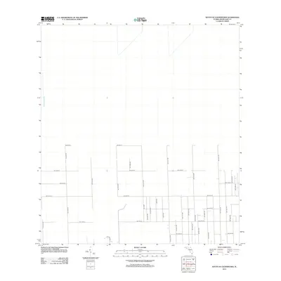
2012 Map of South of Coopertown
USGS Topo · Published 2012About this map
Blue Shanty Canal runs along the western edge of this landscape, representing a significant hydrological feature in Miami-Dade County. The area south of Coopertown is defined by a rigid rectilinear grid of roads that illustrates the systematic parceling of South Florida land for agriculture and rural development. This network includes major corridors such as SW 90th St, SW 104th St, and SW 144th St, which serve as the primary east-west arteries. The north-south avenues, including SW 267th Ave and SW 217th Ave, further divide the territory into large, uniform blocks. The sparsity of structures indicates a transition zone between the developed eastern suburbs and the open wetlands of the Everglades, where the infrastructure is primarily designed for land management and access rather than dense habitation.
Find a feature on this map
30 named features on this map. Tap any name to fly to it.
Don’t see what you’re looking for? This feature index may not catch every label — zoom into the map to look around manually.
Map Details
Editions of this 2012 South of Coopertown Map
This is the sole edition of this map. No revisions or reprints were ever made.
Other maps of this area

1949 · South Miami NW
USGS Topo · 1:24,000

1949 · Goulds
USGS Topo · 1:24,000

1955 · South Miami NW
USGS Topo · 1:24,000

1956 · Goulds
USGS Topo · 1:24,000

1956 · Grossman Hammock
USGS Topo · 1:24,000

1956 · Miami
USGS Topo · 1:250,000

1958 · Miami
USGS Topo · 1:250,000

1972 · Chekika Island
USGS Topo · 1:24,000

1972 · South Of Coopertown
USGS Topo · 1:24,000
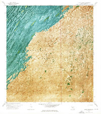
1972 · Black Hammock
USGS Topo · 1:24,000