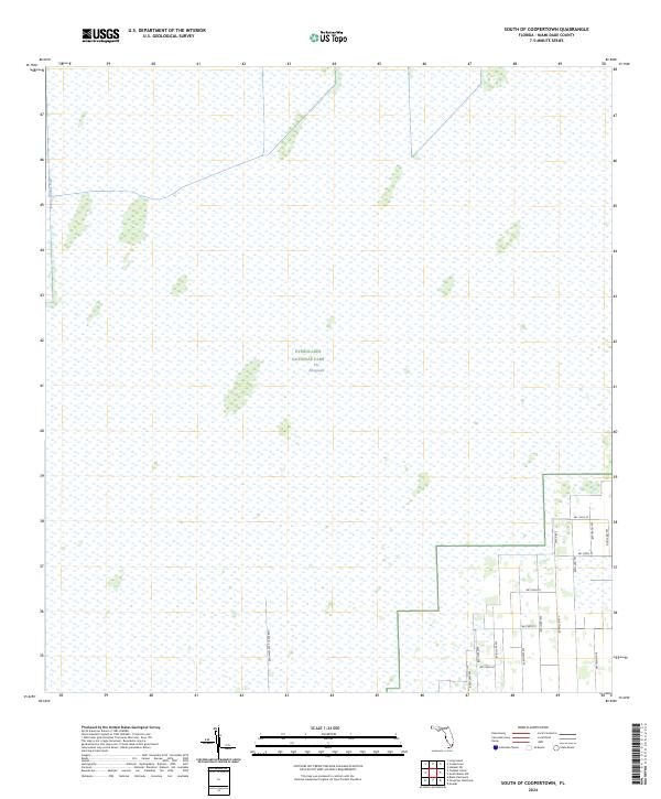
2024 Map of South of Coopertown
USGS Topo · Published 2024About this map
Everglades National Park occupies the vast majority of this landscape, representing a contemporary look at the preservation of The Everglades. The map illustrates the sharp boundary between the protected wetlands and the rural-residential fringe of Miami-Dade County. While the western and northern portions of the quadrangle are dominated by sawgrass and water, the southeastern corner reveals a developing grid of roads such as SW 112th St and SW 209th Ave. This area shows the intersection of human infrastructure and the natural hydrologic system, evidenced by the Blue Shanty Canal which runs along the western edge. This 2024 edition is essential for understanding the modern footprint of the park and the extent of suburban encroachment in South Florida, including long thoroughfares like Free Rte 014 SW 237th Ave.
Find a feature on this map
18 named features on this map. Tap any name to fly to it.
Don’t see what you’re looking for? This feature index may not catch every label — zoom into the map to look around manually.
Map Details
Editions of this 2024 South of Coopertown Map
This is the sole edition of this map. No revisions or reprints were ever made.
Other maps of this area

1949 · South Miami NW
USGS Topo · 1:24,000

1949 · Goulds
USGS Topo · 1:24,000

1955 · South Miami NW
USGS Topo · 1:24,000

1956 · Goulds
USGS Topo · 1:24,000

1956 · Grossman Hammock
USGS Topo · 1:24,000

1956 · Miami
USGS Topo · 1:250,000

1958 · Miami
USGS Topo · 1:250,000

1972 · Chekika Island
USGS Topo · 1:24,000

1972 · South Of Coopertown
USGS Topo · 1:24,000
1972 · Black Hammock
USGS Topo · 1:24,000