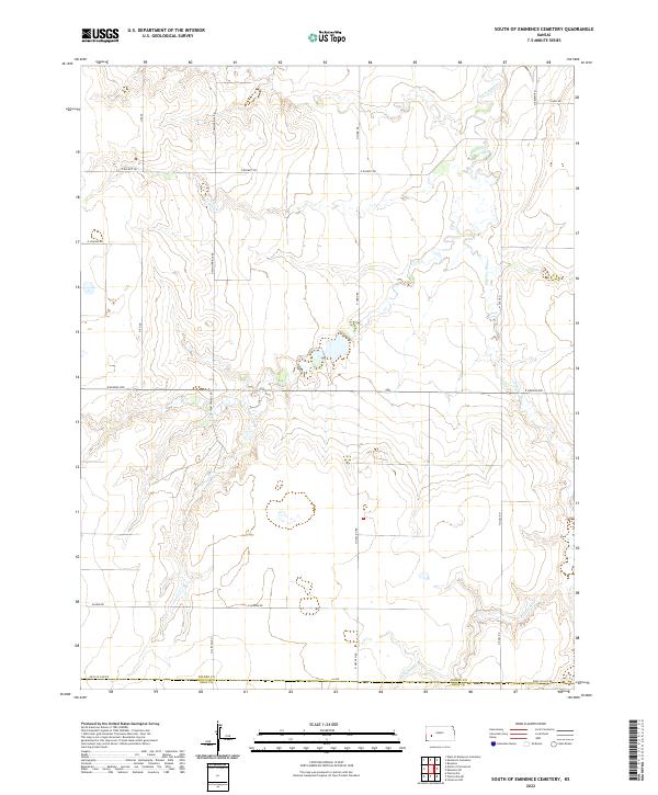
2022 Map of South of Eminence Cemetery
USGS Topo · Published 2022About this map
The Pawnee River meanders across the northern and southeastern reaches of this landscape, carving subtle drainage patterns through the high plains of Southwest Kansas. This 2022 survey documents the section corners and township boundaries along the Finney and Gray County line, reflecting the enduring grid of the Public Land Survey System. The terrain is defined by its agricultural layout, with primary thoroughfares like E Kansas Ave and N Twin Springs Rd serving as the backbone for local transit. The map captures the quiet intersection of geography and property, where family-named routes like Algrim Rd, N Haflich Rd, and N Hund Rd mark the boundaries of rural holdings. It is a precise record of the modern prairie, where the natural course of the river remains the primary deviation from the orderly miles of section roads.
Find a feature on this map
23 named features on this map. Tap any name to fly to it.
Don’t see what you’re looking for? This feature index may not catch every label — zoom into the map to look around manually.
Map Details
Editions of this 2022 South of Eminence Cemetery Map
This is the sole edition of this map. No revisions or reprints were ever made.
Other maps of this area

1892 · Dodge
USGS Topo · 1:125,000

1896 · Garden
USGS Topo · 1:125,000

1955 · Dodge City
USGS Topo · 1:250,000

1955 · Scott City
USGS Topo · 1:250,000

1958 · Dodge City
USGS Topo · 1:250,000

1958 · Scott City
USGS Topo · 1:250,000

1959 · Dodge City
USGS Topo · 1:250,000

1967 · Pierceville
USGS Topo · 1:24,000

1968 · Cimarron NW
USGS Topo · 1:24,000
1968 · Pierceville NE
USGS Topo · 1:24,000