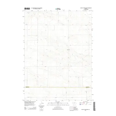
2014 Map of South of Gabe Rock
USGS Topo · Published 2014About this map
The high plains of the Nebraska Panhandle meet at the intersection of the Banner Co and Kimball Co line, revealing a landscape defined by intermittent water and local drainage patterns. Brauer Reservoir sits in the northwest corner, a critical water management feature for this arid agricultural and ranching region. The terrain is notably dissected by Rocky Hollow, which cuts through the central portion of the map, providing a natural contrast to the surrounding plateau. A network of rural section-line roads, including 17 Mile Rd, Co Road 54, and Co Road 6, connects the isolated farmsteads and ranches that characterize this western Nebraska frontier in the early 21st century.
Find a feature on this map
16 named features on this map. Tap any name to fly to it.
Don’t see what you’re looking for? This feature index may not catch every label — zoom into the map to look around manually.
Map Details
Editions of this 2014 South of Gabe Rock Map
This is the sole edition of this map. No revisions or reprints were ever made.
Other maps of this area

1898 · Scotts Bluff
USGS Topo · 1:125,000

1954 · Scottsbluff
USGS Topo · 1:250,000

1958 · Scottsbluff
USGS Topo · 1:250,000

1973 · Kimball 2 NE
USGS Topo · 1:24,000

1973 · Kimball 2 SE
USGS Topo · 1:24,000
1973 · Kimball 2 SW
USGS Topo · 1:24,000

1973 · Scotts Bluff 4 SW
USGS Topo · 1:24,000

1973 · Scotts Bluff 3 SE
USGS Topo · 1:24,000
1973 · Kimball 2 NW
USGS Topo · 1:24,000

1973 · Kimball 1 NW
USGS Topo · 1:24,000