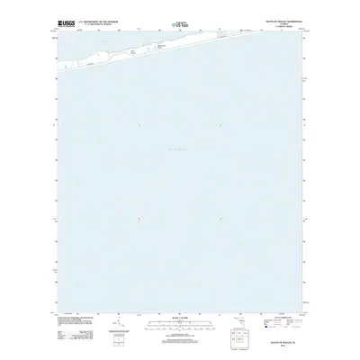
2012 Map of South of Holley
USGS Topo · Published 2012About this map
Santa Rosa Island stretches across the northern portion of this 2012 survey, forming a narrow barrier between the sheltered Santa Rosa Sound and the open Gulf of Mexico. The landscape is dominated by the coastal environment of the Gulf Islands National Seashore, most notably at Opal Beach. A single primary transportation corridor, identified as Co Hwy 399 and Gulf Blvd, runs the length of the spit, providing access to the shoreline and small clusters of infrastructure. The vast majority of the map depicts the offshore waters of the Gulf, making this a focused study of the island's precise shoreline position and the developed road network just before the mid-2010s.
Find a feature on this map
6 named features on this map. Tap any name to fly to it.
Don’t see what you’re looking for? This feature index may not catch every label — zoom into the map to look around manually.
Map Details
Editions of this 2012 South of Holley Map
This is the sole edition of this map. No revisions or reprints were ever made.
Other maps of this area

1921 · Holley
USGS Topo · 1:62,500

1921 · Pensacola
USGS Topo · 1:62,500

1936 · Holley
USGS Topo · 1:48,000

1938 · Holley
USGS Topo · 1:62,500

1941 · Pensacola
USGS Topo · 1:62,500

1942 · Pensacola
USGS Topo · 1:62,500
1944 · Oriole Beach
USGS Topo · 1:25,000
1944 · Garcon Point
USGS Topo · 1:25,000

1957 · Pensacola
USGS Topo · 1:250,000

1959 · Pensacola
USGS Topo · 1:250,000