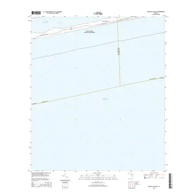
2015 Map of South of Holley
USGS Topo · Published 2015About this map
Gulf Islands National Seashore dominates the northern edge of this coastal survey, preserving a narrow segment of Santa Rosa Island between the open Gulf of Mexico and the calmer waters of Santa Rosa Sound. This barrier island environment is defined by its low-lying topography and shifting sands, with the Florida National Scenic Trail winding through the dunes and scrub. The map illustrates the minimal infrastructure on this protected stretch of coastline, centered on Opal Beach and the parallel routes of Gulf Blvd and White Sands Blvd. The sheet also delineates the offshore maritime boundaries between Santa Rosa and Escambia Counties, showing how these political lines extend far into the gulf waters south of the shoreline.
Find a feature on this map
11 named features on this map. Tap any name to fly to it.
Don’t see what you’re looking for? This feature index may not catch every label — zoom into the map to look around manually.
Map Details
Editions of this 2015 South of Holley Map
This is the sole edition of this map. No revisions or reprints were ever made.
Other maps of this area

1921 · Holley
USGS Topo · 1:62,500

1921 · Pensacola
USGS Topo · 1:62,500

1936 · Holley
USGS Topo · 1:48,000

1938 · Holley
USGS Topo · 1:62,500

1941 · Pensacola
USGS Topo · 1:62,500

1942 · Pensacola
USGS Topo · 1:62,500
1944 · Oriole Beach
USGS Topo · 1:25,000
1944 · Garcon Point
USGS Topo · 1:25,000

1957 · Pensacola
USGS Topo · 1:250,000

1959 · Pensacola
USGS Topo · 1:250,000