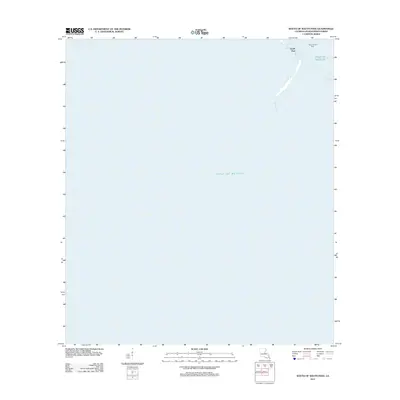
2012 Map of South of South Pass
USGS Topo · Published 2012About this map
Gulf of Mexico waters dominate this coastal survey at the far southern edge of Louisiana's deltaic landscape. The map centers on the maritime interface where the terrestrial environment yields to the sea, defined by the narrow sediment-rich finger of South Pass. This geologically active region represents one of the primary distributaries of the Mississippi River system, where deposition and erosion constantly reshape the land. Industrial activity is indicated in the offshore environment by the Block 30 Gas Field, illustrating the intersection of natural delta formation and energy extraction in the early 21st century. The sparse labels reflect the transition from the marshy terminus of the river to the open ocean.
Find a feature on this map
3 named features on this map. Tap any name to fly to it.
Don’t see what you’re looking for? This feature index may not catch every label — zoom into the map to look around manually.
Map Details
Editions of this 2012 South of South Pass Map
This is the sole edition of this map. No revisions or reprints were ever made.
Other maps of this area

1893 · East Delta
USGS Topo · 1:62,500

1893 · West Delta
USGS Topo · 1:62,500

1935 · Garden Island Pass
USGS Topo · 1:31,680

1935 · South Pass
USGS Topo · 1:31,680

1946 · Mudpan Bayou
USGS Topo · 1:31,680

1947 · Garden Island Pass
USGS Topo · 1:31,680

1947 · Southwest Pass
USGS Topo · 1:31,680

1952 · Southwest Pass
USGS Topo · 1:62,500

1953 · West Delta
USGS Topo · 1:62,500
1954 · Southwest Pass
USGS Topo · 1:31,680