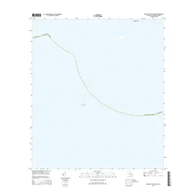
2015 Map of South of South Pass
USGS Topo · Published 2015About this map
Gulf of Mexico waters dominate this coastal survey, reaching the very edges of the Mississippi River Delta at its southernmost extent. The maritime boundary of Plaquemines Parish arcs across the open water, marking the jurisdictional limit in this sensitive estuarine environment. In the upper right corner, the entrance to South Pass provides a crucial navigational marker where the river finally meets the sea. This 2015 edition captures a landscape defined almost entirely by its hydrology, where the land has largely receded or shifted, leaving only the primary shipping channel as a bridge between the inland delta and the open gulf.
Find a feature on this map
4 named features on this map. Tap any name to fly to it.
Don’t see what you’re looking for? This feature index may not catch every label — zoom into the map to look around manually.
Map Details
Editions of this 2015 South of South Pass Map
This is the sole edition of this map. No revisions or reprints were ever made.
Other maps of this area

1893 · East Delta
USGS Topo · 1:62,500

1893 · West Delta
USGS Topo · 1:62,500

1935 · Garden Island Pass
USGS Topo · 1:31,680

1935 · South Pass
USGS Topo · 1:31,680

1946 · Mudpan Bayou
USGS Topo · 1:31,680

1947 · Garden Island Pass
USGS Topo · 1:31,680

1947 · Southwest Pass
USGS Topo · 1:31,680

1952 · Southwest Pass
USGS Topo · 1:62,500

1953 · West Delta
USGS Topo · 1:62,500
1954 · Southwest Pass
USGS Topo · 1:31,680