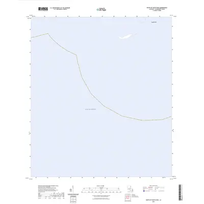
2024 Map of South of South Pass
USGS Topo · Published 2024About this map
South Pass marks the northern limit of this coastal survey, where the terrestrial world gives way to the open waters of the Gulf of Mexico. Located at the distal tip of the Mississippi River Delta in Plaquemines Parish, this map documents the contemporary coastline and the shifting shoals where the river's influence meets the sea. The sparse detail on this sheet reflects the dynamic nature of the birdfoot delta, where landmasses are frequently subject to erosion and submergence. Researchers and mariners can observe the current shoreline geometry of South Pass and the surrounding marine environment, providing a specific data point for the ongoing geological and hydrological changes at one of the southernmost points of the United States.
Find a feature on this map
2 named features on this map. Tap any name to fly to it.
Don’t see what you’re looking for? This feature index may not catch every label — zoom into the map to look around manually.
Map Details
Editions of this 2024 South of South Pass Map
This is the sole edition of this map. No revisions or reprints were ever made.
Other maps of this area

1893 · East Delta
USGS Topo · 1:62,500

1893 · West Delta
USGS Topo · 1:62,500

1935 · Garden Island Pass
USGS Topo · 1:31,680

1935 · South Pass
USGS Topo · 1:31,680

1946 · Mudpan Bayou
USGS Topo · 1:31,680

1947 · Garden Island Pass
USGS Topo · 1:31,680

1947 · Southwest Pass
USGS Topo · 1:31,680

1952 · Southwest Pass
USGS Topo · 1:62,500

1953 · West Delta
USGS Topo · 1:62,500
1954 · Southwest Pass
USGS Topo · 1:31,680