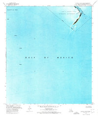
1971 Map of South of South Pass
USGS Topo · Published 1974About this map
South Pass serves as the focal point of this coastal orthophotomap, where the Mississippi River delta meets the open sea. This 1971 record highlights the industrial presence of the Block 27 Oil Field, with several offshore Platform locations identified across the deep blue waters. Along the narrow strip of land at the delta's edge, the East Jetty and various Light markers guide maritime traffic through the shifting channels. The northeastern corner of the map covers a portion of the Pass A Loutre State Waterfowl Management Area, showing the delicate balance between energy extraction and conservation in the Gulf of Mexico. The presence of an Indefinite Boundary reflects the constantly evolving nature of the Louisiana shoreline and submerged lands during the early 1970s.
Find a feature on this map
8 named features on this map. Tap any name to fly to it.
Don’t see what you’re looking for? This feature index may not catch every label — zoom into the map to look around manually.
Map Details
Editions of this 1971 South of South Pass Map
This is the sole edition of this map. No revisions or reprints were ever made.
Other maps of this area

1893 · East Delta
USGS Topo · 1:62,500

1893 · West Delta
USGS Topo · 1:62,500

1935 · Garden Island Pass
USGS Topo · 1:31,680

1935 · South Pass
USGS Topo · 1:31,680

1946 · Mudpan Bayou
USGS Topo · 1:31,680

1947 · Garden Island Pass
USGS Topo · 1:31,680

1947 · Southwest Pass
USGS Topo · 1:31,680

1952 · Southwest Pass
USGS Topo · 1:62,500

1953 · West Delta
USGS Topo · 1:62,500
1954 · Southwest Pass
USGS Topo · 1:31,680