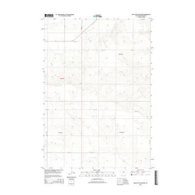
2015 Map of South of Volunteer
USGS Topo · Published 2015About this map
Bear Butte Cr and Alkali Cr define the drainage patterns of this Meade County landscape, where the high plains begin their transition into more complex relief. The map reveals a highly structured section-line road network typical of the American West, anchored by thoroughfares such as Alkali Rd and Middle Alkali Rd. These routes, alongside north-south connectors like 141st Ave and 142nd Ave, trace the boundaries of the Public Land Survey System grids, specifically crossing townships t6n r7e and t5n r8e. This 2015 survey illustrates how modern infrastructure in South Dakota continues to adhere to nineteenth-century land divisions, providing a clear view of the rural ranching and agricultural framework of the region east of the Black Hills.
Find a feature on this map
14 named features on this map. Tap any name to fly to it.
Don’t see what you’re looking for? This feature index may not catch every label — zoom into the map to look around manually.
Map Details
Editions of this 2015 South of Volunteer Map
This is the sole edition of this map. No revisions or reprints were ever made.
Other maps of this area

1893 · Rapid
USGS Topo · 1:125,000

1898 · Rapid
USGS Topo · 1:125,000

1903 · Rapid
USGS Topo · 1:125,000

1906 · Vale
USGS Topo · 1:62,500

1913 · Newell
USGS Topo · 1:125,000

1951 · Volunteer
USGS Topo · 1:24,000

1951 · Volunteer SE
USGS Topo · 1:24,000

1951 · Vale SE
USGS Topo · 1:24,000

1951 · Vale
USGS Topo · 1:62,500

1953 · Rapid City 1 SW
USGS Topo · 1:24,000