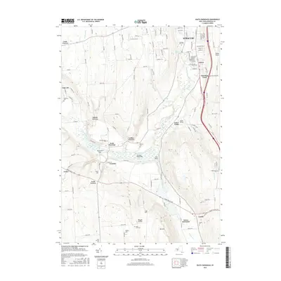
2016 Map of South Onondaga
USGS Topo · Published 2016About this map
Onondaga Creek carves a deep path through this portion of central New York, shaping the agricultural and residential patterns south of Syracuse. The landscape is defined by its dramatic relief, where deep incisions like Peppermill Gulf and the broad Tully Valley contrast with prominent heights such as Bare Mtn and Case Hill. This geography has long influenced local settlement, from the Indian Village and Onondaga Castle to rural crossroads like South Onondaga and Baileys Settlement. Historic transit corridors follow the valley floors, evidenced by the Cherry Valley Tpke and the Hitchings Road Bridge over the creek. Small family and community burial grounds, including the Budlong Cem and Saint Patricks Cem, are scattered across the hillsides, anchoring the genealogy of this upland territory.
Find a feature on this map
126 named features on this map. Tap any name to fly to it.
Don’t see what you’re looking for? This feature index may not catch every label — zoom into the map to look around manually.
Map Details
Editions of this 2016 South Onondaga Map
This is the sole edition of this map. No revisions or reprints were ever made.
Other maps of this area

1895 · Syracuse
USGS Topo · 1:62,500

1898 · Syracuse
USGS Topo · 1:62,500

1899 · Skaneateles
USGS Topo · 1:62,500

1900 · Baldwinsville
USGS Topo · 1:62,500

1900 · Tully
USGS Topo · 1:62,500

1902 · Skaneateles
USGS Topo · 1:62,500

1938 · Syracuse East
USGS Topo · 1:24,000

1939 · Syracuse West
USGS Topo · 1:24,000
1943 · Syracuse East
USGS Topo · 1:31,680

1943 · South Onondaga
USGS Topo · 1:31,680