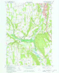
1973 Map of South Onondaga
USGS Topo · Published 1977About this map
Onondaga Indian Reservation land occupies the central valley of this 1970s survey, where the Onondaga Creek flows north toward the urban edge of Syracuse. The landscape transitions from the city's suburban southern fringe at Nedrow and Onondaga Castle into a series of rural hamlets and agricultural crossroads. Local family names and early settlements are well-preserved across the terrain, from Baileys Settlement in the southeast to Cards Corners in the northwest.
Find a feature on this map
95 named features on this map. Tap any name to fly to it.
Don’t see what you’re looking for? This feature index may not catch every label — zoom into the map to look around manually.
Map Details
Editions of this 1973 South Onondaga Map
This is the sole edition of this map. No revisions or reprints were ever made.
Other maps of this area

1895 · Syracuse
USGS Topo · 1:62,500

1898 · Syracuse
USGS Topo · 1:62,500

1899 · Skaneateles
USGS Topo · 1:62,500

1900 · Baldwinsville
USGS Topo · 1:62,500

1900 · Tully
USGS Topo · 1:62,500

1902 · Skaneateles
USGS Topo · 1:62,500

1938 · Syracuse East
USGS Topo · 1:24,000

1939 · Syracuse West
USGS Topo · 1:24,000
1943 · Syracuse East
USGS Topo · 1:31,680

1943 · South Onondaga
USGS Topo · 1:31,680