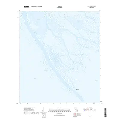
2020 Map of South Pass
USGS Topo · Published 2020About this map
Port Eads serves as the primary outpost on this coastal survey, situated at the extreme terminus of the Mississippi River delta. This maritime landscape is defined by the intricate branching of the South Pass, which channels river water into the Gulf of Mexico through a complex network of waterways including Grand Pass and Dennis Pass. The map documents a fragile environment of marshes and siltation, where family-named features like Valentiers Pond and Cognevich Pass suggest a long history of local navigation and commercial fishing. The presence of the Port Eads Sanitary Canal and sheltered anchorage in Whale Bay highlights the area's role as a vital staging point for deep-water marine operations and offshore industry. Inland, the terrain is dominated by shallow basins such as Morgan Pond and small rises like Lookout Island, providing a detailed view of the shifting deltaic geography in the early twenty-first century.
Find a feature on this map
25 named features on this map. Tap any name to fly to it.
Don’t see what you’re looking for? This feature index may not catch every label — zoom into the map to look around manually.
Map Details
Editions of this 2020 South Pass Map
This is the sole edition of this map. No revisions or reprints were ever made.
Other maps of this area

1893 · East Delta
USGS Topo · 1:62,500

1893 · West Delta
USGS Topo · 1:62,500

1935 · Garden Island Pass
USGS Topo · 1:31,680

1935 · South Pass
USGS Topo · 1:31,680

1946 · Mudpan Bayou
USGS Topo · 1:31,680

1947 · Garden Island Pass
USGS Topo · 1:31,680

1947 · Pass A Loutre West
USGS Topo · 1:31,680

1947 · Southwest Pass
USGS Topo · 1:31,680

1947 · Pass A Loutre East
USGS Topo · 1:31,680

1949 · Cubits Gap
USGS Topo · 1:31,680