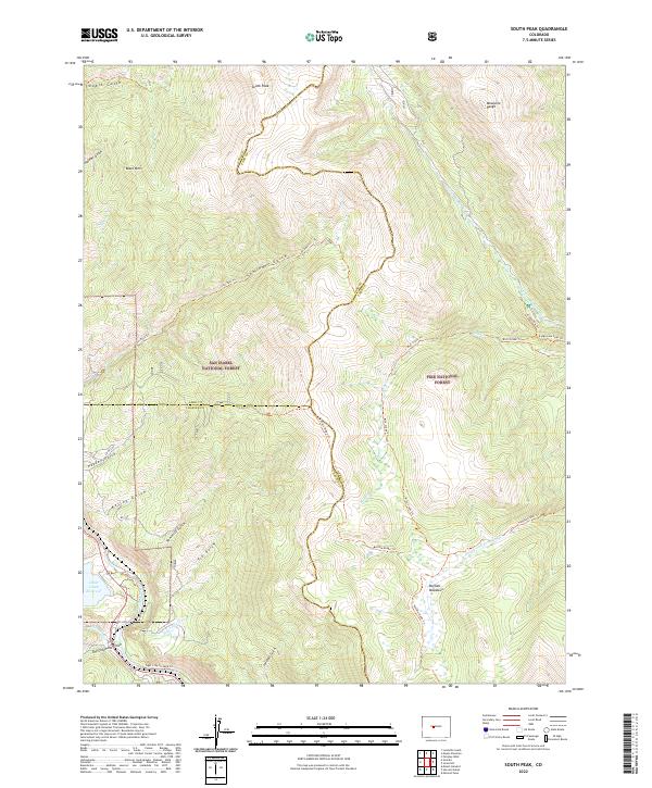
2022 Map of South Peak
USGS Topo · Published 2022About this map
South Peak and the high ridges of the Mosquito Range dominate this high-altitude landscape where the headwaters of the S Fork S Platte River and the Arkansas River find their origins. The terrain is defined by a dense network of gulches, including Twobit Gulch, Hayden Gulch, and Sawmill Gulch, which channel snowmelt toward larger basins. A prominent hydrological feature is the Clear Creek Reservoir in the southwest corner, situated near the confluence of Columbia Creek and Dry Columbia Gulch.
Find a feature on this map
38 named features on this map. Tap any name to fly to it.
Don’t see what you’re looking for? This feature index may not catch every label — zoom into the map to look around manually.
Map Details
Editions of this 2022 South Peak Map
This is the sole edition of this map. No revisions or reprints were ever made.
Other maps of this area

1889 · Leadville
USGS Topo · 1:125,000

1891 · Leadville
USGS Topo · 1:125,000

1935 · Mount Elbert
USGS Topo · 1:62,500

1938 · Mount Elbert
USGS Topo · 1:62,500

1939 · Mount Elbert
USGS Topo · 1:62,500

1942 · Leadville
USGS Topo · 1:125,000

1955 · Buena Vista
USGS Topo · 1:62,500

1955 · Mount Harvard
USGS Topo · 1:62,500

1956 · Montrose
USGS Topo · 1:250,000

1957 · Leadville
USGS Topo · 1:250,000