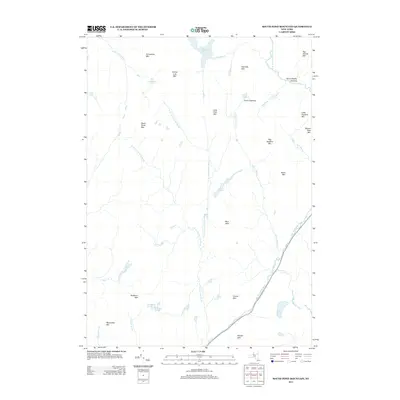
2013 Map of South Pond Mountain
USGS Topo · Published 2013About this map
The E Br Sacandaga River carves through the southeastern corner of this Adirondack landscape, providing a primary drainage route for the surrounding high country. Unlike many developed regions, this area is defined by isolated clearings such as Burnt Shanty Clearing and Curtis Clearing, which mark small openings in the dense forest cover. The terrain is a complex arrangement of peaks including South Pond Mtn, Big Shanty Mtn, and the Blue Hills, interspersed with numerous high-altitude water bodies like the Siamese Ponds and South Pond. The map reveals a wild hydrology where Kunjamuk River and County Line Brook navigate the gaps between summits. For the researcher, the absence of major roads highlights a primitive backcountry character, where movement was historically dictated by stream valleys like Stockholm Brook and Shanty Brook.
Find a feature on this map
39 named features on this map. Tap any name to fly to it.
Don’t see what you’re looking for? This feature index may not catch every label — zoom into the map to look around manually.
Map Details
Editions of this 2013 South Pond Mountain Map
This is the sole edition of this map. No revisions or reprints were ever made.
Other maps of this area

1898 · Thirteenth Lake
USGS Topo · 1:62,500

1899 · Indian Lake
USGS Topo · 1:62,500

1902 · Indian Lake
USGS Topo · 1:62,500

1907 · Lake Pleasant
USGS Topo · 1:62,500

1910 · Stony Creek
USGS Topo · 1:62,500

1950 · Utica
USGS Topo · 1:250,000

1954 · Lake Pleasant
USGS Topo · 1:62,500

1954 · Thirteenth Lake
USGS Topo · 1:62,500

1954 · Indian Lake
USGS Topo · 1:62,500

1954 · Harrisburg
USGS Topo · 1:62,500