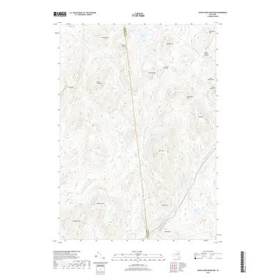
2019 Map of South Pond Mountain
USGS Topo · Published 2019About this map
The Kunjamuk River and the East Branch Sacandaga River define this high-elevation landscape in the Adirondacks. This modern survey illustrates a topography of connected waterways and isolated clearings, such as Burnt Shanty Clearing and Curtis Clearing, which speak to the historic human presence in these woods. The border between Hamilton Co and Warren Co runs through the center of the map, bisecting features like County Line Mtn and County Line Brook. To the north, the Siamese Ponds and Siamese Brook sit between Siamese Mtn and Long Pine Mtn. The southern portion of the quadrangle is marked by wetland environments including Hayes Flow and the Buckhorn Ponds, nestled beneath the steep slopes of Macomber Mtn and Buckhorn Mtn.
Find a feature on this map
41 named features on this map. Tap any name to fly to it.
Don’t see what you’re looking for? This feature index may not catch every label — zoom into the map to look around manually.
Map Details
Editions of this 2019 South Pond Mountain Map
This is the sole edition of this map. No revisions or reprints were ever made.
Other maps of this area

1898 · Thirteenth Lake
USGS Topo · 1:62,500

1899 · Indian Lake
USGS Topo · 1:62,500

1902 · Indian Lake
USGS Topo · 1:62,500

1907 · Lake Pleasant
USGS Topo · 1:62,500

1910 · Stony Creek
USGS Topo · 1:62,500

1950 · Utica
USGS Topo · 1:250,000

1954 · Lake Pleasant
USGS Topo · 1:62,500

1954 · Thirteenth Lake
USGS Topo · 1:62,500

1954 · Indian Lake
USGS Topo · 1:62,500

1954 · Harrisburg
USGS Topo · 1:62,500