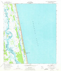
1952 Map of South Ponte Vedra Beach
USGS Topo · Published 1972About this map
South Ponte Vedra Beach sits along a narrow barrier strip between the Atlantic Ocean and the Guana River, a landscape defined by its coastal geography in the early 1950s. The map illustrates a network of tidal marshlands and creeks, including Smith Creek and Capo Creek, which fed into the prominent Tolomato River. This waterway served as a critical segment of the Intracoastal Waterway, maintained at a project depth of 9 feet to facilitate maritime traffic. Small riverfront sites such as Spanish Landing, Booth Landing, and Cook Landing suggest a reliance on water access for the local community. Further south, Shell Bluff Landing and various islands like Pine Island and Medicis Island dot the inland waters, providing a clear picture of the St. Johns County coastline before modern expansion reshaped the barrier island's character.
Find a feature on this map
19 named features on this map. Tap any name to fly to it.
Don’t see what you’re looking for? This feature index may not catch every label — zoom into the map to look around manually.
Map Details
Editions of this 1952 South Ponte Vedra Beach Map
5 editions found
Other maps of this area

1918 · Palm Valley
USGS Topo · 1:62,500

1937 · Bakersville
USGS Topo · 1:24,000

1937 · St. Augustine
USGS Topo · 1:24,000

1943 · St. Augustine
USGS Topo · 1:62,500

1948 · Jacksonville
USGS Topo · 1:250,000
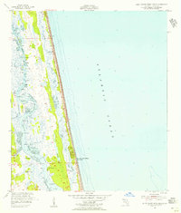
1952 · South Ponte Vedra Beach
USGS Topo · 1:24,000
1952 · Durbin
USGS Topo · 1:24,000
1952 · Mickler Landing
USGS Topo · 1:24,000
1952 · Palm Valley
USGS Topo · 1:24,000

1954 · Daytona Beach
USGS Topo · 1:250,000