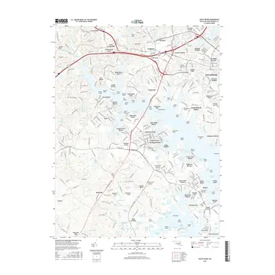
2016 Map of South River
USGS Topo · Published 2016About this map
Annapolis and its southwestern suburbs meet the sprawling tidal reaches of the South River in this detailed 2016 survey. The landscape is defined by a series of residential peninsulas and "necks," including Annapolis Neck and Selby-on-the-Bay, where the land fractures into numerous points and coves like Beards Point and Mayo Point. This modern record captures the dense development of communities such as Edgewater, Londontowne, and Parole, while preserving the location of older institutional sites.
Find a feature on this map
327 named features on this map. Tap any name to fly to it.
Don’t see what you’re looking for? This feature index may not catch every label — zoom into the map to look around manually.
Map Details
Editions of this 2016 South River Map
This is the sole edition of this map. No revisions or reprints were ever made.
Other maps of this area

1892 · Owensville
USGS Topo · 1:62,500

1892 · Annapolis
USGS Topo · 1:62,500

1893 · North Point
USGS Topo · 1:62,500

1894 · Relay
USGS Topo · 1:62,500

1895 · Owensville
USGS Topo · 1:62,500

1898 · Choptank
USGS Topo · 1:125,000

1898 · Tolchester
USGS Topo · 1:125,000

1899 · Patuxent
USGS Topo · 1:125,000

1903 · Tolchester
USGS Topo · 1:125,000
1904 · North Point
USGS Topo · 1:62,500