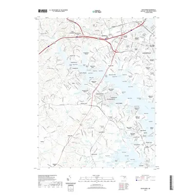
2019 Map of South River
USGS Topo · Published 2019About this map
Annapolis and its southwestern suburbs flank the broad South River in this detailed topographic study of Anne Arundel County. The landscape is a complex network of residential peninsulas and protected marshes, including the South River Headwaters Marsh and Muddy Creek Marsh. Inland, smaller agricultural and crossroads communities like Birdsville, Mill Swamp, and Dodon persist amidst expanding developments such as Parole and Londontowne. Genealogists will find a high density of burial sites documented, ranging from the Annapolis Hebrew Cem near Oak Court to the Hope Methodist Episcopal Chapel Cem along Central Ave E. The map also highlights the aviation footprint of Lee Airport near Edgewater Beach, and the many tributary creeks and coves, like Almshouse Creek and Beards Creek Marsh, that define the region's shoreline character.
Find a feature on this map
188 named features on this map. Tap any name to fly to it.
Don’t see what you’re looking for? This feature index may not catch every label — zoom into the map to look around manually.
Map Details
Editions of this 2019 South River Map
This is the sole edition of this map. No revisions or reprints were ever made.
Other maps of this area

1892 · Owensville
USGS Topo · 1:62,500

1892 · Annapolis
USGS Topo · 1:62,500

1893 · North Point
USGS Topo · 1:62,500

1894 · Relay
USGS Topo · 1:62,500

1895 · Owensville
USGS Topo · 1:62,500

1898 · Choptank
USGS Topo · 1:125,000

1898 · Tolchester
USGS Topo · 1:125,000

1899 · Patuxent
USGS Topo · 1:125,000

1903 · Tolchester
USGS Topo · 1:125,000

1904 · North Point
USGS Topo · 1:62,500