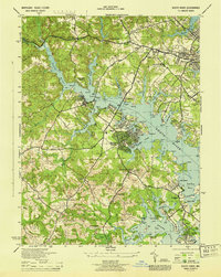
1944 Map of South River
USGS Topo · Published 1944About this map
Woodland Beach and Sylvan Shores emerge as densely plotted residential developments along the jagged Chesapeake tributaries during this mid-century period. The landscape is defined by the complex hydrology of the South River, where numerous points like Beards Pt and Larramore Pt extend into the water, creating a network of sheltered creeks including Church Creek and Glebe Creek. Further inland, the map captures the rural infrastructure of Anne Arundel County, featuring the Annapolis Waterworks and institutions such as the Almshouse and County Home. Genealogists may find value in the specific locations of All Hallows Church, the Annapolis Cemetery, and local schools like Mill Swamp School. The presence of Camp Pawatinika and Camp Letts indicates the area's role in early 20th-century recreation and youth organization, while the Defense Highway suggests the strategic military transport needs of the wartime era.
Find a feature on this map
88 named features on this map. Tap any name to fly to it.
Don’t see what you’re looking for? This feature index may not catch every label — zoom into the map to look around manually.
Map Details
Editions of this 1944 South River Map
This is the sole edition of this map. No revisions or reprints were ever made.
Other maps of this area

1892 · Owensville
USGS Topo · 1:62,500

1892 · Annapolis
USGS Topo · 1:62,500

1893 · North Point
USGS Topo · 1:62,500

1894 · Relay
USGS Topo · 1:62,500

1895 · Owensville
USGS Topo · 1:62,500

1898 · Choptank
USGS Topo · 1:125,000

1898 · Tolchester
USGS Topo · 1:125,000

1899 · Patuxent
USGS Topo · 1:125,000

1903 · Tolchester
USGS Topo · 1:125,000

1904 · North Point
USGS Topo · 1:62,500