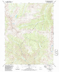
1986 Map of South River Peak
USGS Topo · Published 1986About this map
South River Peak and the surrounding high-altitude terrain of the Weminuche Wilderness dominate this mid-1980s topographical survey along the border of the Rio Grande National Forest and San Juan National Forest. The map documents a critical stretch of the Continental Divide, where high-country drainage patterns feed into systems like the West Fork San Juan River and Goose Creek. Significant for those tracking early recreation and resource extraction, the sheet shows the winding path of the Continental Divide Trail and a noted Mine located near a cabin site in the northwestern quadrant.
Find a feature on this map
24 named features on this map. Tap any name to fly to it.
Don’t see what you’re looking for? This feature index may not catch every label — zoom into the map to look around manually.
Map Details
Editions of this 1986 South River Peak Map
This is the sole edition of this map. No revisions or reprints were ever made.
Other maps of this area

1905 · San Cristobal
USGS Topo · 1:125,000

1907 · San Cristobal
USGS Topo · 1:125,000

1913 · Summitville
USGS Topo · 1:125,000

1914 · Creede
USGS Topo · 1:125,000

1915 · Summitville
USGS Topo · 1:125,000

1916 · Creede
USGS Topo · 1:125,000

1924 · Pagosa Springs
USGS Topo · 1:125,000

1927 · Pagosa Springs
USGS Topo · 1:125,000

1945 · Durango
USGS Topo · 1:250,000

1953 · Durango
USGS Topo · 1:250,000