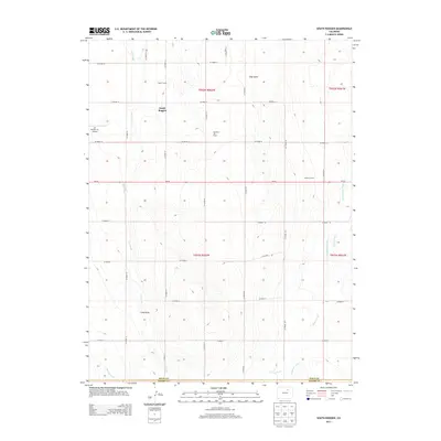
2013 Map of South Roggen
USGS Topo · Published 2013About this map
South Roggen sits at the heart of this High Plains landscape, where the agricultural traditions of the early 21st century meet modern energy extraction. The map reveals a highly structured grid of county roads, such as CO Road 14 and CO Road 79, that organize the vast open spaces of Weld County and Adams County. Significant local operations like Triple K Farms and Cooksey Farms underscore the region's ranching and farming character, while the Ranchero Oil Field points to the area's industrial subsurface wealth. Specialized local infrastructure is visible at the Air Dusters Inc Airport, likely serving the needs of local crop-dusting efforts. Water management is a defining feature of the terrain, from the prominent Henrylyn Canal in the southwest to the winding paths of Lost Creek and Kiowa Creek, which traverse the prairie toward landmarks like Hay Gulch and Long Draw.
Find a feature on this map
33 named features on this map. Tap any name to fly to it.
Don’t see what you’re looking for? This feature index may not catch every label — zoom into the map to look around manually.
Map Details
Editions of this 2013 South Roggen Map
This is the sole edition of this map. No revisions or reprints were ever made.
Other maps of this area

1949 · Sunnydale
USGS Topo · 1:24,000

1950 · South Roggen
USGS Topo · 1:24,000

1950 · Wiggins SW
USGS Topo · 1:24,000

1950 · Tampa
USGS Topo · 1:24,000

1950 · Prospect Valley
USGS Topo · 1:24,000

1951 · Prospect Valley
USGS Topo · 1:24,000

1951 · Living Springs
USGS Topo · 1:24,000

1951 · Roggen
USGS Topo · 1:24,000

1951 · Leader NW
USGS Topo · 1:24,000

1951 · Omar
USGS Topo · 1:24,000